My backup: Navigation using Organic Maps
While I mainly use a Garmin navigation device on my journeys, I need a backup just in case it breaks. With the mobile app Organic.Maps I found a great solution. Organic.Maps is a fork of Maps.me that was formed when Maps.me started
offering paid services.
Characteristics of Organic Maps
Organic.Maps is available for iOS and Android, uses Openstreetmap Data and is free.
The share way:
The easiest way to use your KML with Organic.Maps is to share it from a chat app like whatsapp or signal. Both apps have a function to send yourself a message. Use that to send yourself the KML.
Whatsapp is used on an Apple mobile in the following example. Using Android mobiles, it shouldn’t work much different.
1) On your PC, convert your GPX file using GPX_2_KML_4_Orga. Find the program later here.
2) Drag & Drop that new KML file onto “Whatsapp Web” by sending yourself a message.
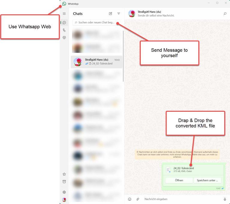
3) Now use your mobile:

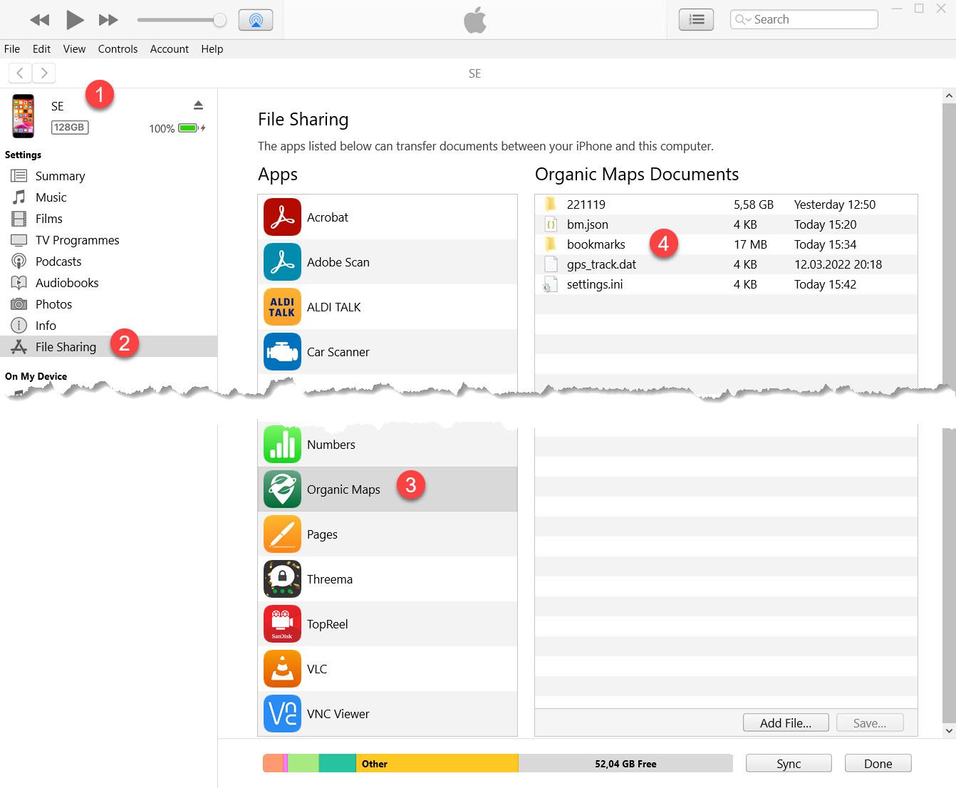
The iTunes way:
Route planning
The planning of the routes (tracks & waypoints) is done as usual in Basecamp.
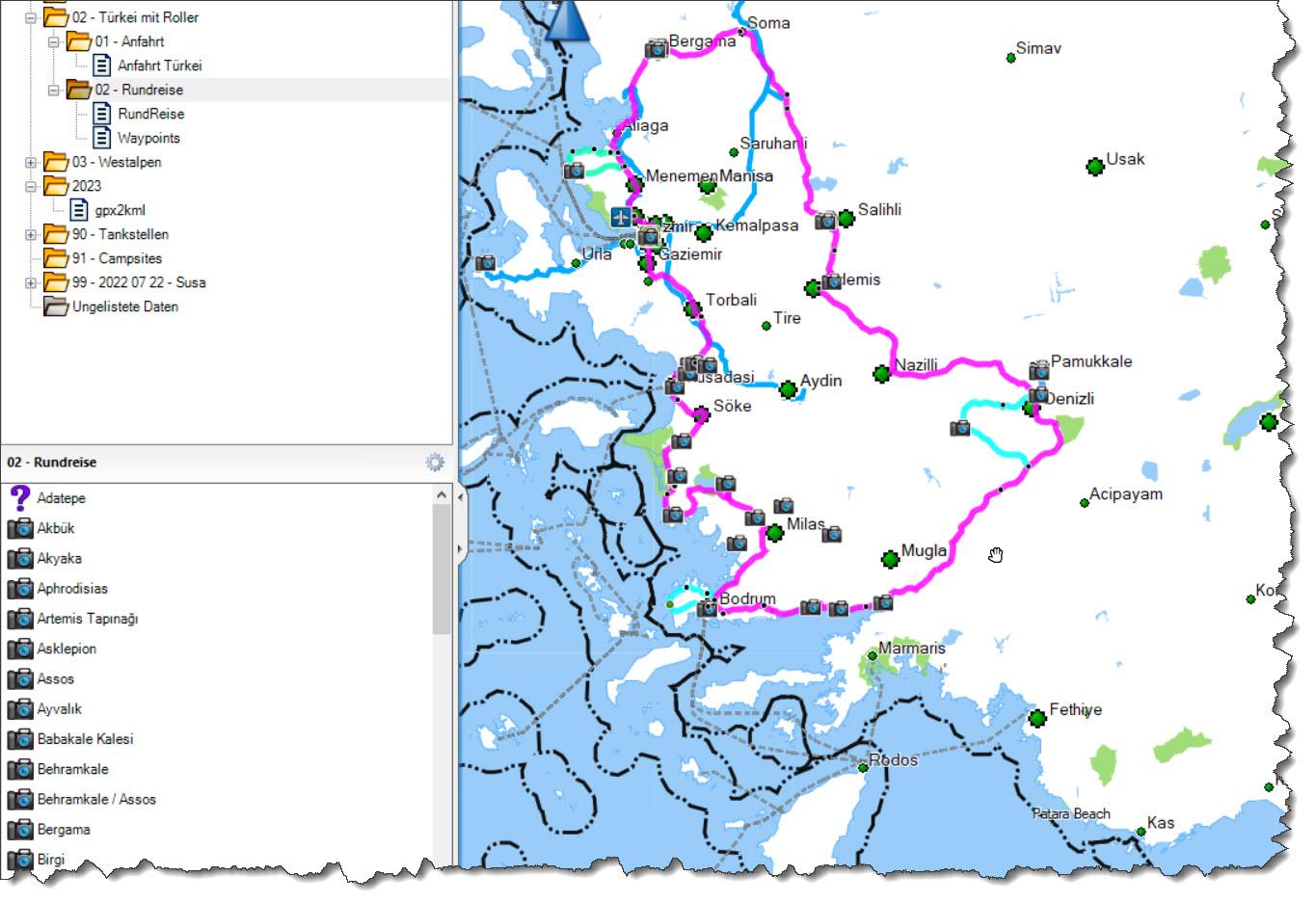
From Basecamp, the planning data is exported as GPX and converted into KML using my program GPX_2_KML_4_Orga.exe. Exporting directly from Basecamp to KML will not fully suit colors etc!
In the end it looks something like this:
Best Practice
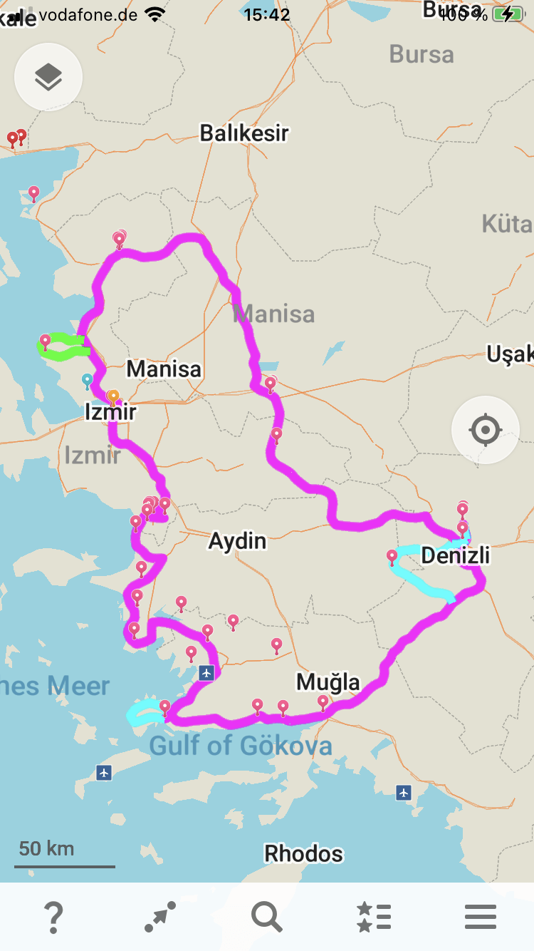
To increase readability, it is a good idea to divide a longer tour into individual routes (e.g. by day). This gives you the possibility to switch on/off the individual routes (days) in Organic.Maps. In addition, you can see immediately where the day’s stage starts and ends.
The Program
To convert the GPX data into a meaningful KML for Organic.maps there are two options:
1) A smart way is is to use the webservice provided. For details & access goto to
https://gravelmaps.de/tools/
2) Download and run the program.
- The program is published on Github.
- Select the green button “<> Code”
- Select: Download ZIP
- Unload the ZIP File to a working directory.
- On Github follow the readme.
- If you want to know more details, see the readme-licence.pdf.