Android: Using Garmin maps with Oruxmaps
Oruxmaps is an excellent navigation app for Android. It can use maps in Garmin format – so the maps from Gravel Maps can be used.
To improve readability, I have developed a special layout for use with Android and Oruxmaps.
Download of the maps
If you don’t want to read on: Here is where you get the maps:
The maps work perfect!
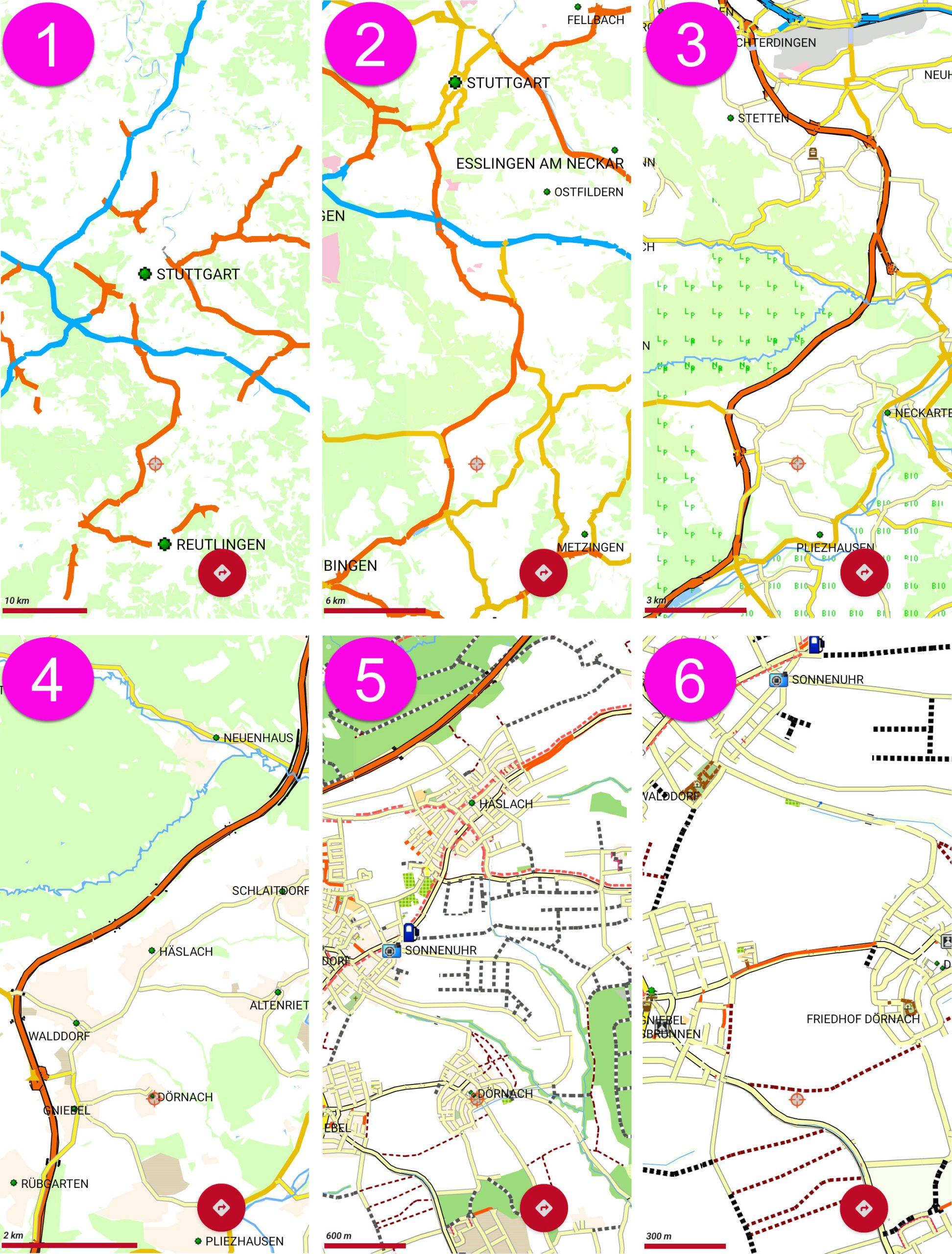
Zooming the map
See how the Gravelmaps will show in your Android. The example walks through the zoom levels:
Installation
Installation is slightly different depending on the Android version and manufacturer, but it is easy to accomplish. I have put together my own instructions. These are only available in German at the moment, but should be self-explanatory.
The version of Oruxmaps I am using is 10.5.0. GP.
- The manual is published on Github.
- Select the green button “<> Code”
- Select: Download ZIP
- Unload the ZIP File to a working directory.
- Read!
Another document was shared by by Steve B. in 2022
Steve was using the install instruction below to the current version of Orux (9.0.4) & found the path has changed a bit, as well as the URL for the manuals.Steve was so kind to provide his updates in a PDF:
Installing the map
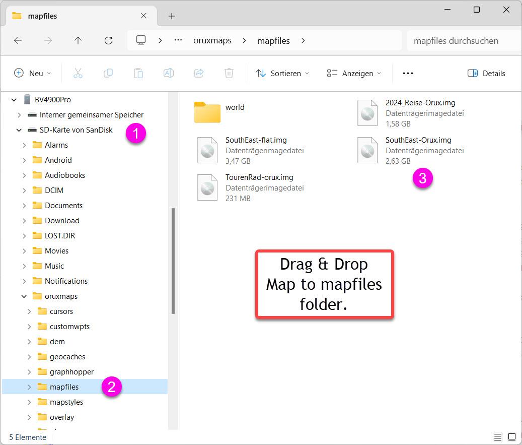
1. Open Windows File Explorer. Lookup your mobile. Open \oruxmaps\mapfiles folder.
In case you prefer to store your data on SD-Card, make sure to use the right path.
2. Drag & Drop the map of your choice into the \oruxmaps\mapfiles folder.
- Open the folder select icon.
- In case the map isn’t shown automatically, press the refresh wheel
- Now select the map
Finish
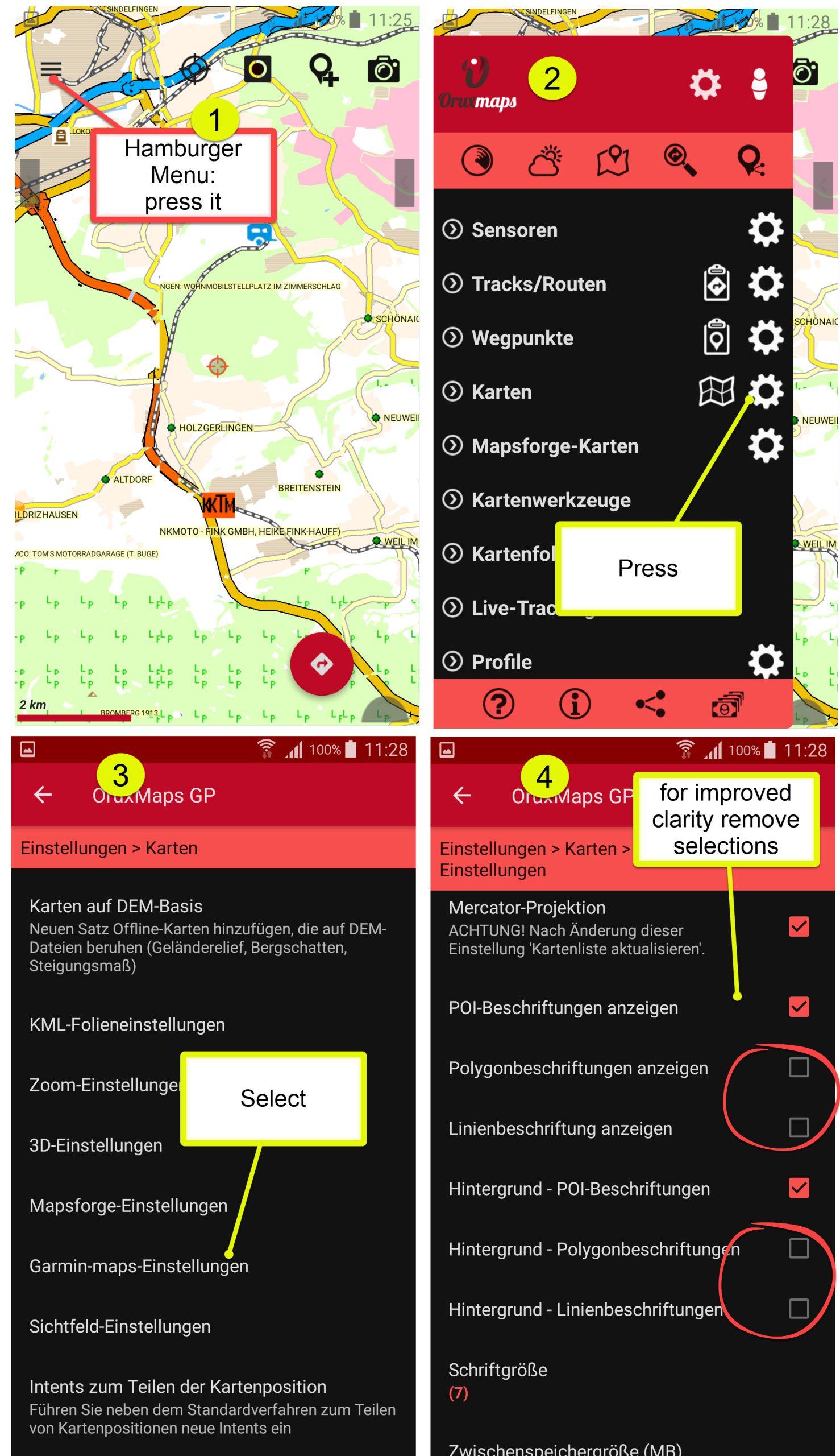
Setting up the Garmin Maps in OruxMaps
In order to have a well arranged appearance of the map, adjustments have to be made.
POI Handling
For use with Oruxmaps, you receive certain Points of Interrest in a special KML format.
Initial load
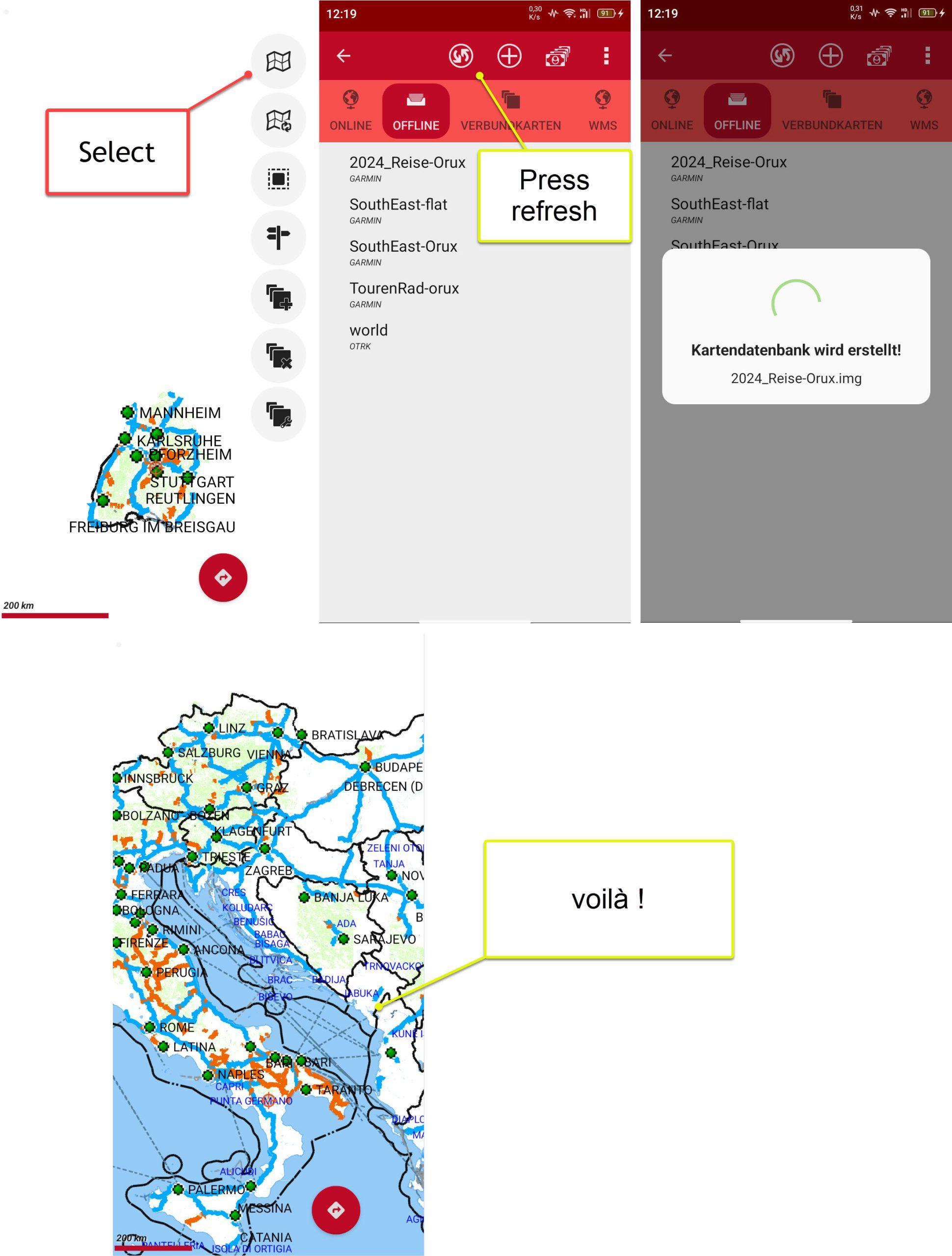
The most simple way to use the POI the first time is to download the files from the website using your mobile.
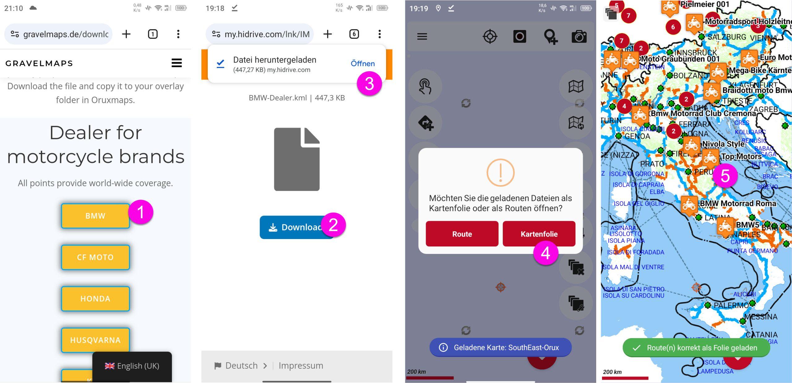
- Click the POI file of your choice
- Download file
- Open file
- Choose Overlay (NOT route)
- See all the POIs, in our case all BMW dealer
Re-Enabling KML overlays (POI, Tracks Waypoints)
If you have deleted the POIs, tracks, waypoints once, and want to see them again, you can proceed as follows:
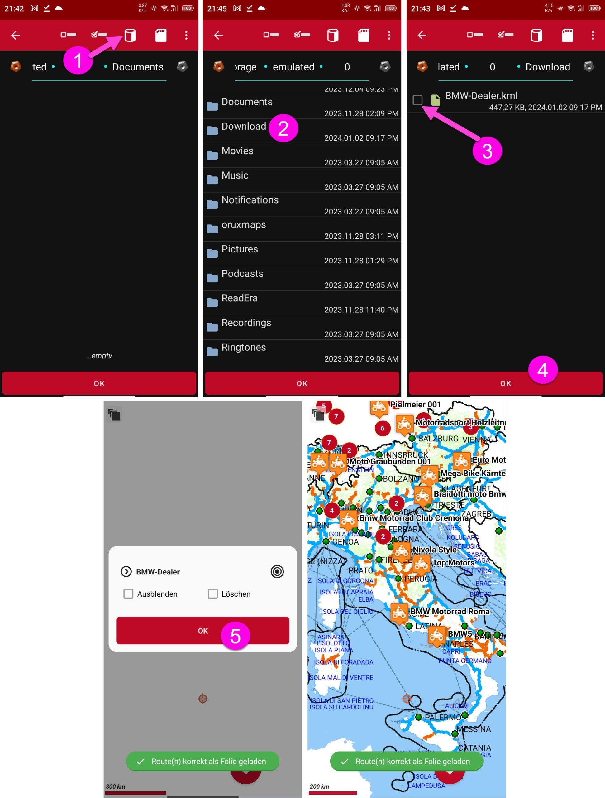
- Select internal storage
- Select download
- Select the file of your choice
- Press OK
- Another OK
Finish!
Formatting Tracks and Waypoints
GPX tracks and waypoints are displayed very basic by default. This is different if you edit them with Garmin Basecamp. In Oruxmaps, these tracks can then be used with colour and line width, waypoints with icons and text – as long as you use my little program for conversion.
With this tool you can convert Garmin GPX Tracks & Waypoints into the KML format used by Oruxmaps.
- The program is published on Github. This makes sure you pull the latest version.
- Search for Releases at the right side
- Select “latest”
- Download “GPX_2_KML_4_Orux.exe”
- Download “GPX_2_KML_4_Orux.json”
- Alternatively download and unzip “source.zip” in the same working directory
- If you want to know more details, see the readme-licence.pdf.
Handling Tracks and Waypoints
The use of tracks and waypoints is identical to the use of POIs. It is best to copy the data directly into a directory on your mobile phone and import it from there
1) Tracks as a route or overlay
2) Waypoints as an overlay.
It has proven to be a good idea to separate the tracks and waypoints into separate files.
You can read more about this in my little booklet in the section “GPX tracks and overlays in Oruxmaps”.
For the moment the booklet is only available in German. However, it should be self-explanatory.
- The manual is published on Github.
- Select the green button “<> Code”
- Select: Download ZIP
- Unload the ZIP File to a working directory.
- Read!