Legend & Layout
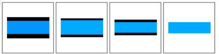
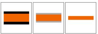
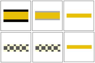
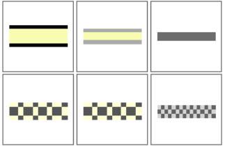
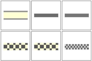
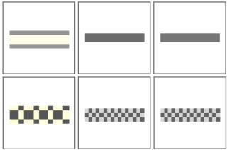
Roads, tracks, lines
From left to right: Zoomed in for the most detail -> far out
The second line indicates whether the road or path is unpaved (gravel, dirt, grass, etc.).
Highway
Trunk
Primary
Secondary

Tertiary
Unclassified, Residential
Living, Service
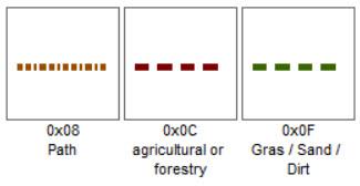
Track

Path, Tracks Agricultural, Forestry, Gras, Dirt
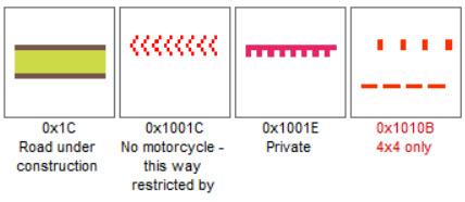
Restrictions
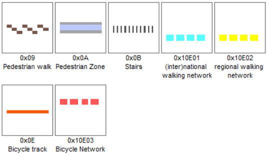
Pedestrian & Bicycle
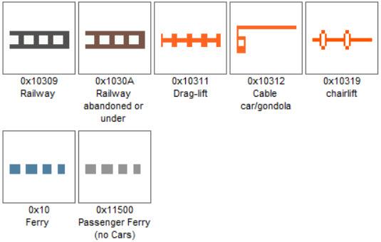
Railway, Ferry and Lift
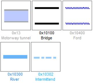
Above and below
Left, Right & Borders
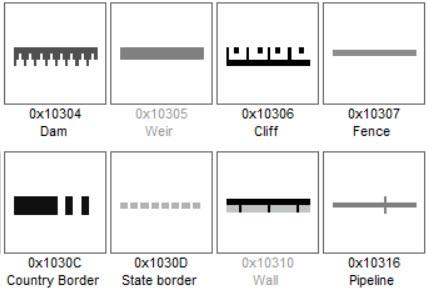
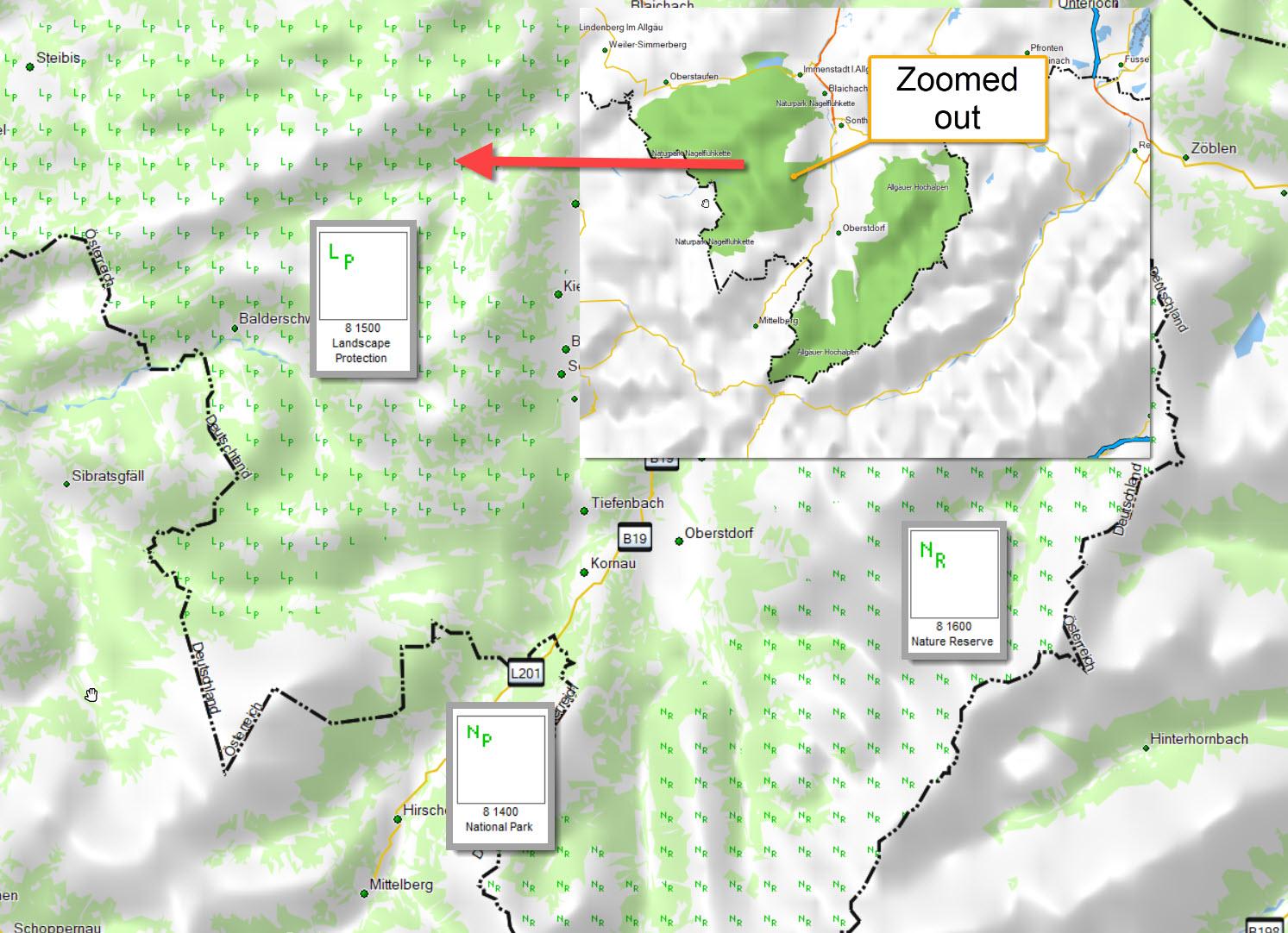
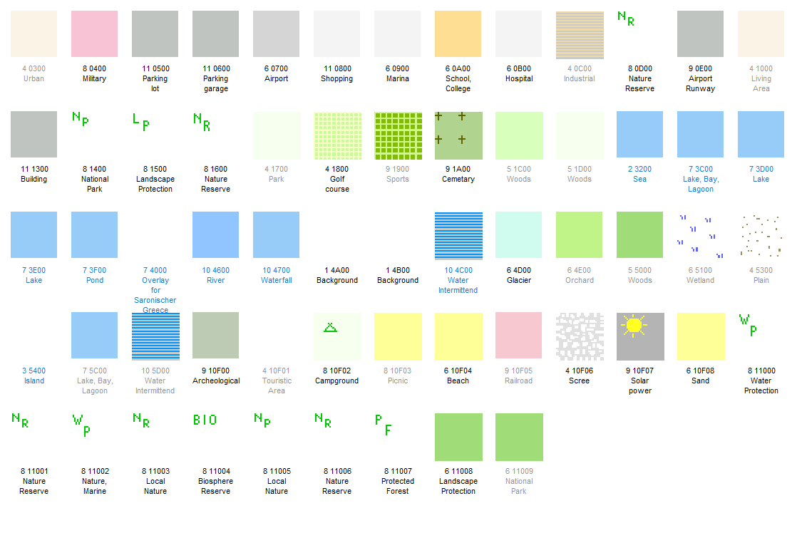
Surface areas
Most of the areas are self-explanatory. I would like to highlight two, as these are areas where you should think very carefully about whether to enter them:
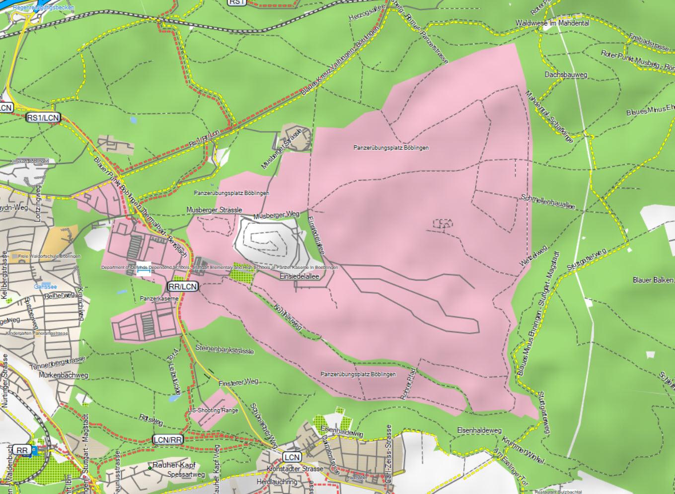
To understand all surface representations, view the image below. Click on it to enlarge.
Some areas appear more than once due to the way they are displayed at different zoom levels.
Example: 1C00 -> 1D00 -> 5000. All 3 icons are necessary to display forest.
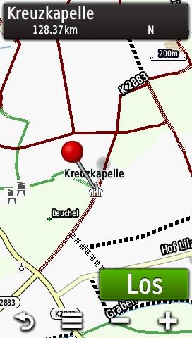
Points
If there are any points on the map that are unclear, you can find the explanation here. Click on the image below to enlarge:

Layout
The Gravelmaps come with two possible layouts. You can change the layout at any time. For instructions see the separate menu item (changing maps layout).
Basecamp Thin Layout
The thin layout makes areas with a high density of roads easier to read and is specially designed for display on PC screens. All Basecamp files (Windows Installer, GMAP) are pre-set to it. See an example in the short video:
Basecamp Wide Layout
For all Garmin image files (Region.img), the wide layout is the default. This layout improves readability on the small displays of Garmin GPS devices.
See an example in the short video:
Garmin Wide Layout
For all Garmin image files (Region.img), the wide layout is the default. This layout improves readability on the small displays of Garmin GPS devices.