Basecamp: Handling the map
Routing Options
When you plan a route, you must specify a routing profile in Basecamp. Depending on the use (bike, car, motorcycle…) Basecamp will route other ways. I get good results for offroad routing this way:
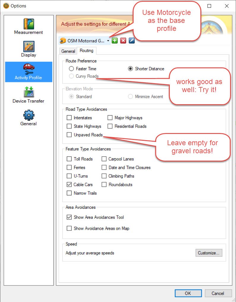
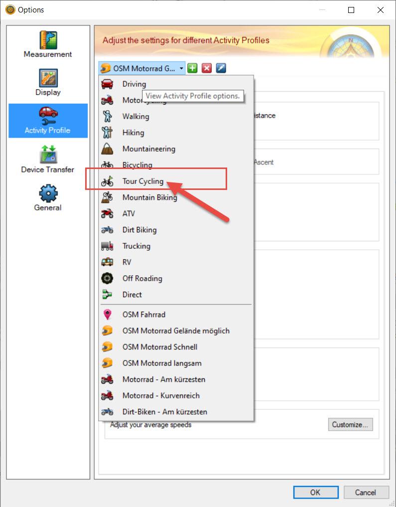
In most cases this profile works well. In some cases (when gravel roads should not be accessed by motorcars – but I want to pass them) I use the “Tour Cycling” profile:
Basecamp & Elevation
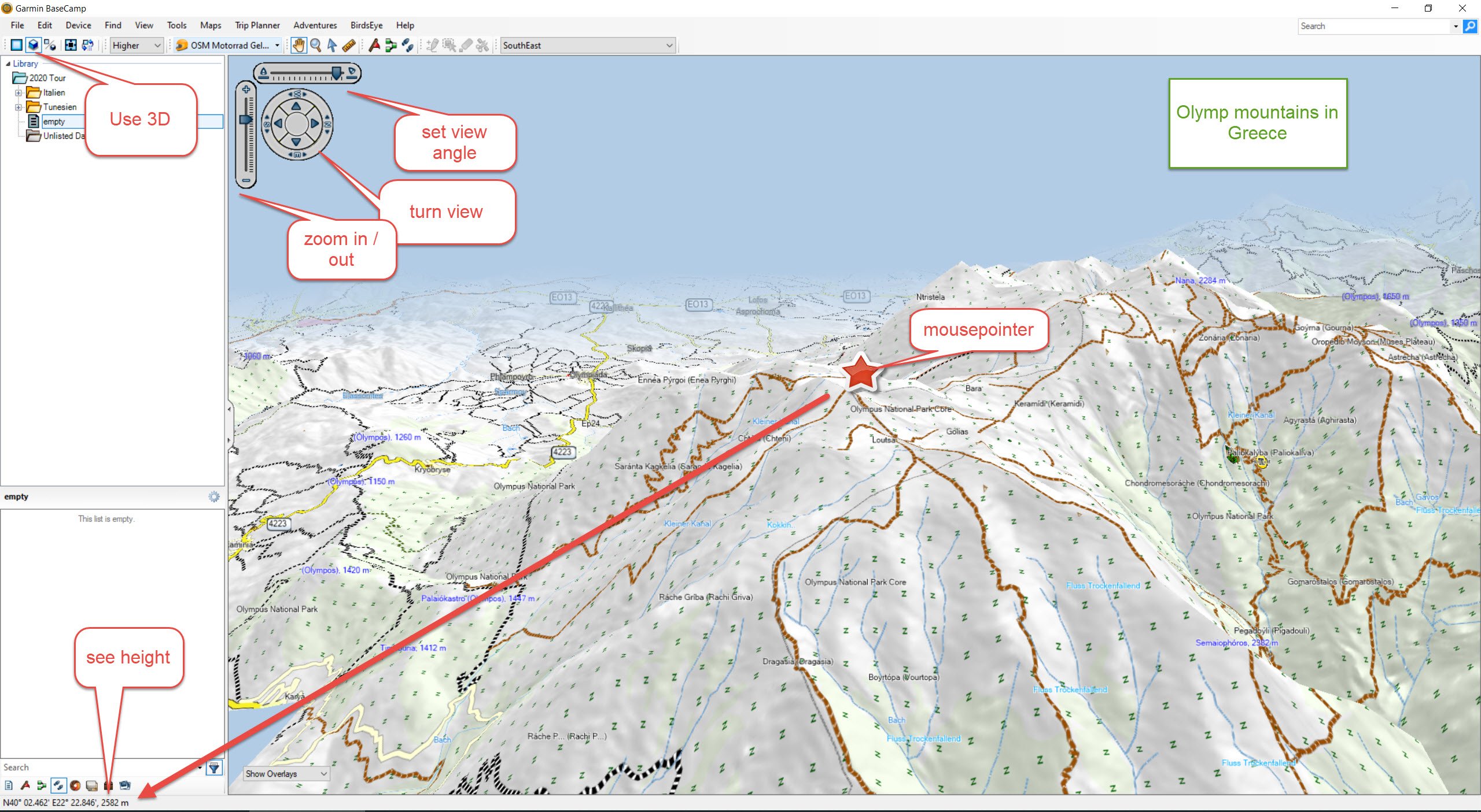
If you are planning a route into the unknown, it may be quite important to get an impression of the terrain. Since the Gravelmaps include excellent elevation data, you can do it as follows: